2019 – 2024
O’Hara, Waiuku
Client: Gardon Trust
O’Hara isn’t just another Common Ground exemplar project, it’s the Waiuku community battling City Hall (Auckland Council) for the right to live the way they chose.
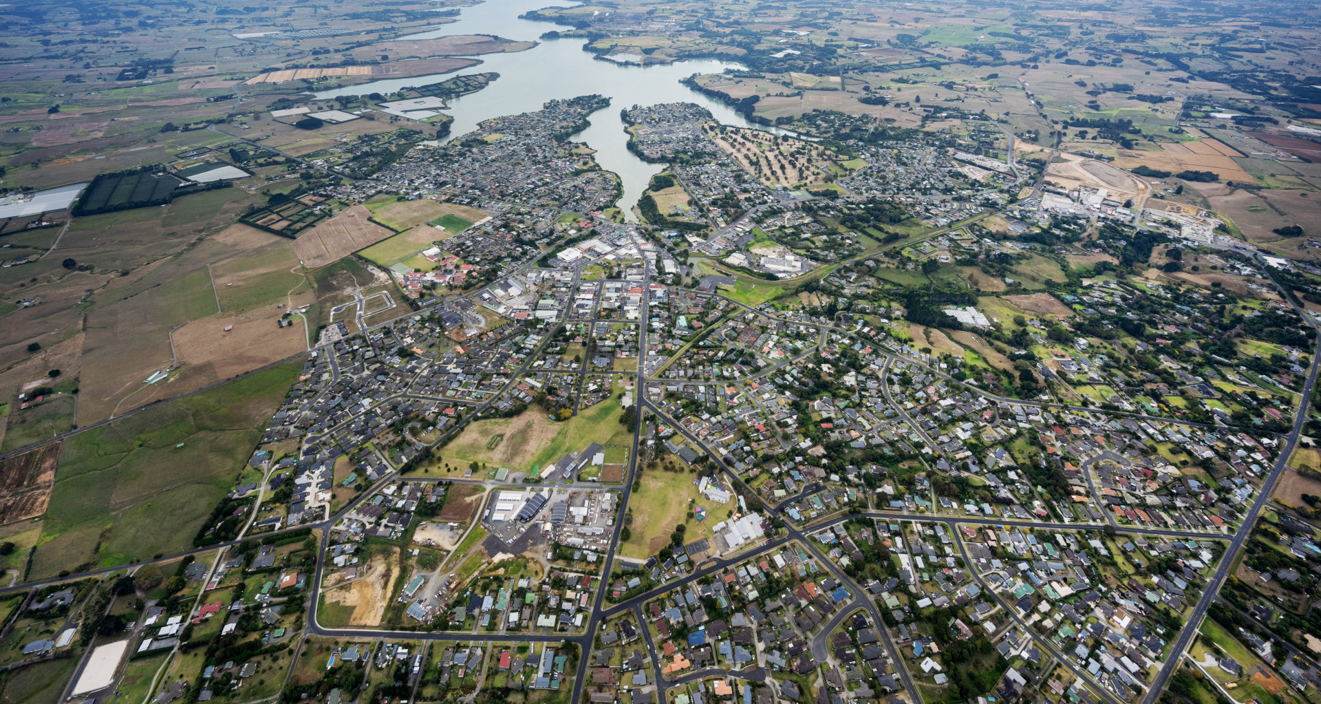
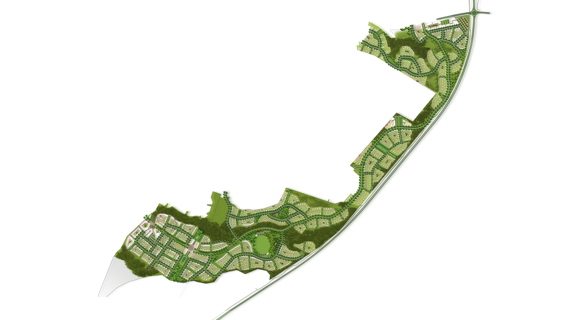
Through nobody’s fault, the town has been in planning limbo for 20 yrs. Full, it has no zoned space available in which to grow. O’Hara is a 32ha farm block contained within the shape of the town that for all those 20 yrs was considered the obvious place to absorb residential development. This is a story of how greenfield development, when done appropriately, can fix things and help a town rise to its potential.
Read More
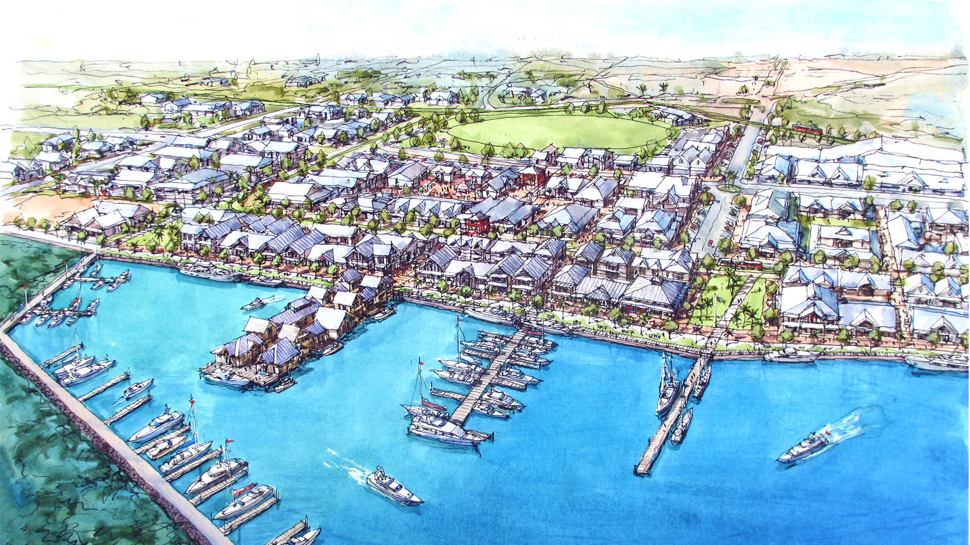
In many ways, for us, the project felt like an endpoint. It’s been a pulling together and rounding off of all of the design ‘innovations’ we’ve developed over the years – the Theory of Edges, greenway and living street design, natural networks and modal shift, urban performance modelling. If all that sounds a bit dry, at its heart is the idea that, given the right form, a community can give expression to itself in any number of different ways. It doesn’t need to be stuck with a one-size-fits-all ‘anywhere suburbia’.
The O’Hara project is one of those rare birds that drops to ground fully formed and perfect in many ways. Waiuku itself is something of a textbook settlement, its form, containment, district context. It is clearly defined in terms of character, identity, ‘purpose’. But it’s unfinished. All our design had to do was complete the form within natural boundaries. The physical gifts we were given were the property’s shape and proportion, proximity (<1km) to the town centre, a natural stream – a defensible edge – on the furthest western edge, site topography, extensive playing fields and high school to the east.
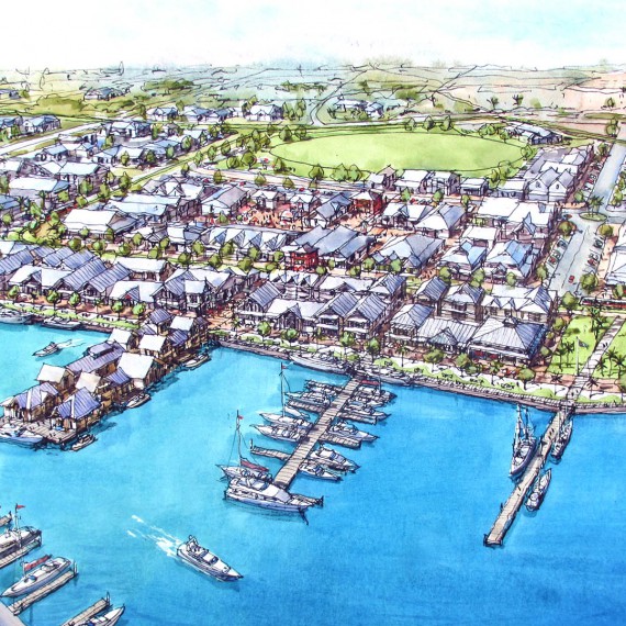
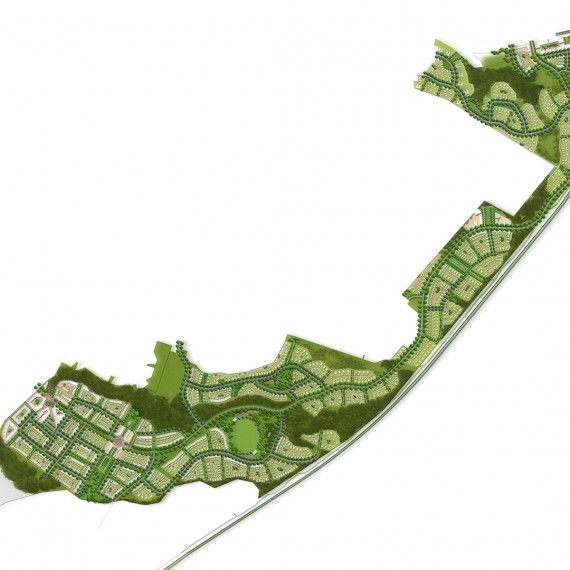
The Greenway and Connectivity
The concept development scheme is driven by open-space connectivity that both enables a proper open-space network for the whole of Waiuku and creates a proper pedestrian off-road movement network to connect to the town centre. Given proximity to town, proximity to the harbour, the quality open-space reserve and school on the site boundary and conditional on the use of Greenways within the site, a modal shift can be guaranteed.
Living Streets and Density
The design itself is a demonstration of how to use Living Streets to extend the power and amenity value of Greenways throughout the site. As an exemplar, it provides a solid basis on which maximum yield models can be calculated for the measurement of environmental effect, knowing that at the upper density end the quality of living amenity and the protection of existing built-form character can be maintained.
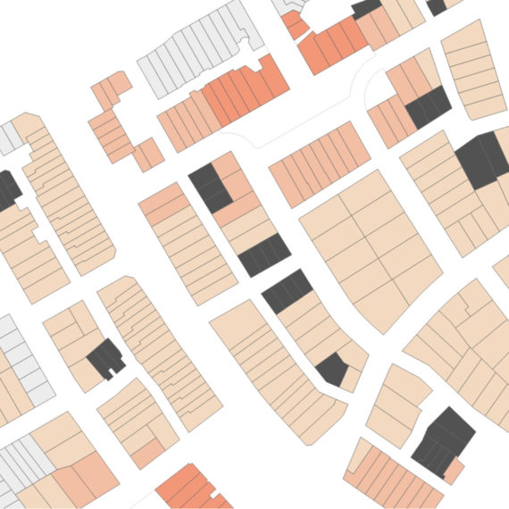
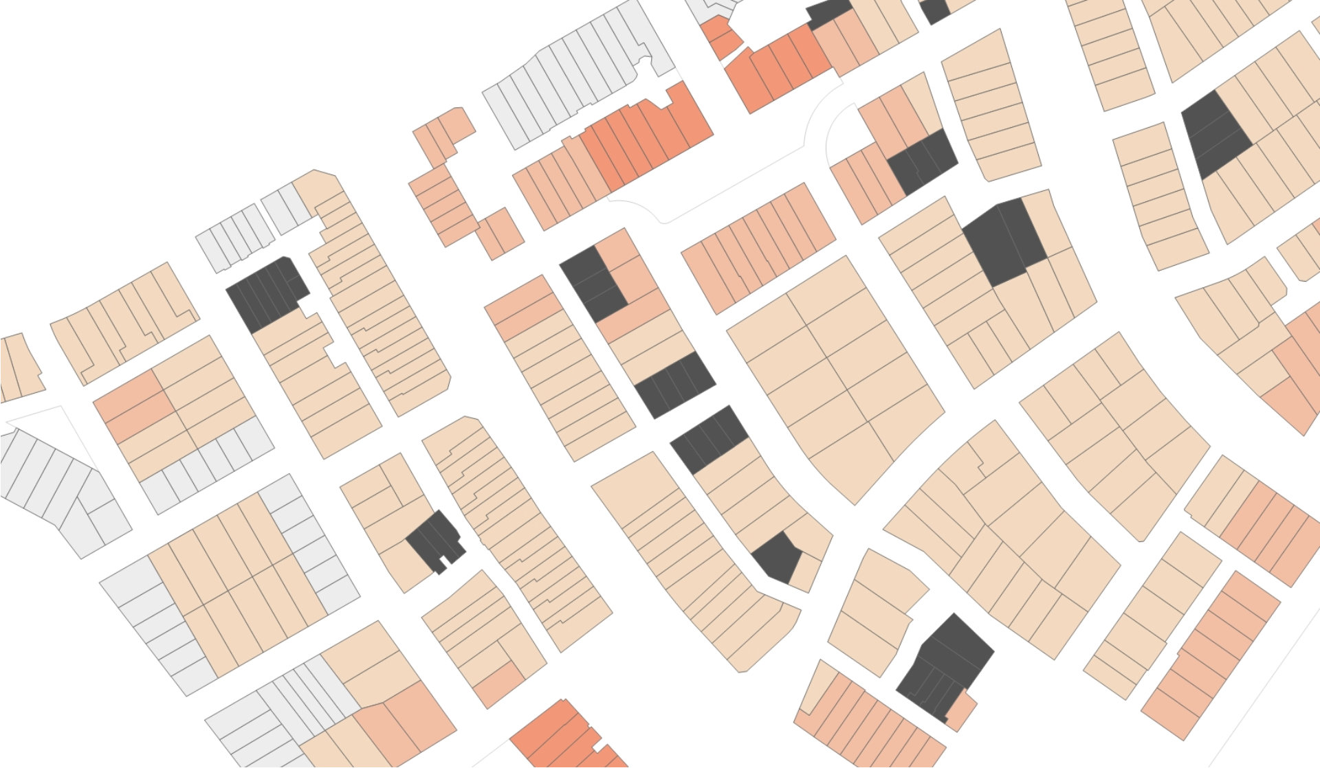
A set of site requirements was provided by the community – everything that had to fit on a site to satisfy and protect the Waiuku character and way of life (4-bedroom house, on-site parking for 4 vehicles, 75m2 living court, freestanding houses, and so on). Configuring roads and vehicle access according to urban-design best-practice, it was then possible to heat-map the amenity of the site. Those site requirements were mapped on top of the amenity map and translated into different lot sizes. The resultant density range produced potential net densities of 30—45 hhu/ha. This is true medium density, but with no attached housing and with exceptional amenity values.
Urban Performance
The recently developed Residential Subdivision (RSP) tool was applied to the concept scheme to provide an objective assessment of urban functionality and value for the plan change. A similar sized area having similar properties was selected from existing Waiuku suburbia and assessed in the same way to determine the extent the plan change would diminish or add to the urban value of Waiuku:
- Plan change area – 91
- Existing Waiuku – 19
(Scores out of 100; comparative plan-sets of the data visualisations are illustrated here)
Regarding a Well-functioning Urban Environment (WFUE), 91 is an extraordinary result when 17—22 is typical for most New Zealand suburbs.
O’Hara Plan Change
So, if the plan change design was extraordinary, the plan change process was even more-so, but not in a good way. From the outset the Council were vehemently opposed to Waiuku being able to grow. Ridiculous claims (eg it will create a car-centric environment; plan-enabled infill housing will create a WFUE) through to straight out mis-information (eg the development proposes its road access comes through the Council recreation reserve) was used to argue that growth demand in Waiuku was better provided for elsewhere in the region. By which they really meant ‘Auckland’ growth. ‘Waiuku’ growth, apparently, doesn’t exist, despite Waiuku being the second largest rural town in the Auckland region with a catchment population of 20,000.
In the end it came down to the Environment Court which roundly rejected the Council’s claims, the decision coming down in favour of Waiuku and local community.
Many of the parts that make up the O’Hara design are referenced elsewhere on this site:
- TOE – the Theory of Edges
- Greenway Design
- RSP – urban performance modelling
- Mews access and lot performance
- District Context Analysis
- Urban Design
- Development Modelling
- Council Hearing Evidence
- Environment Court Evidence
Project Value:
$NZ 300M (2024)
Value of Services Provided:
$NZ 70,000
Added Value:
- Strategies for more sustainable development
- Unlocked opportunities for iwi and education partnerships
- Strengthening Waiuku identity and independence
- Concept Masterplan
- Density Model
- Urban Design Report
- Precinct Plan
- Enabled Waiuku open-space network
- Traditional suburbia tissue analysis
- Plan Change successful


