2022—2026
Yorke Road Development, Haruru Falls
Client: East Property Investments
Yorke Road is a small and beautiful development, a natural enclave. If it carries any message at all, it’s what can happen when you honour to the full what nature is offering.
Read More
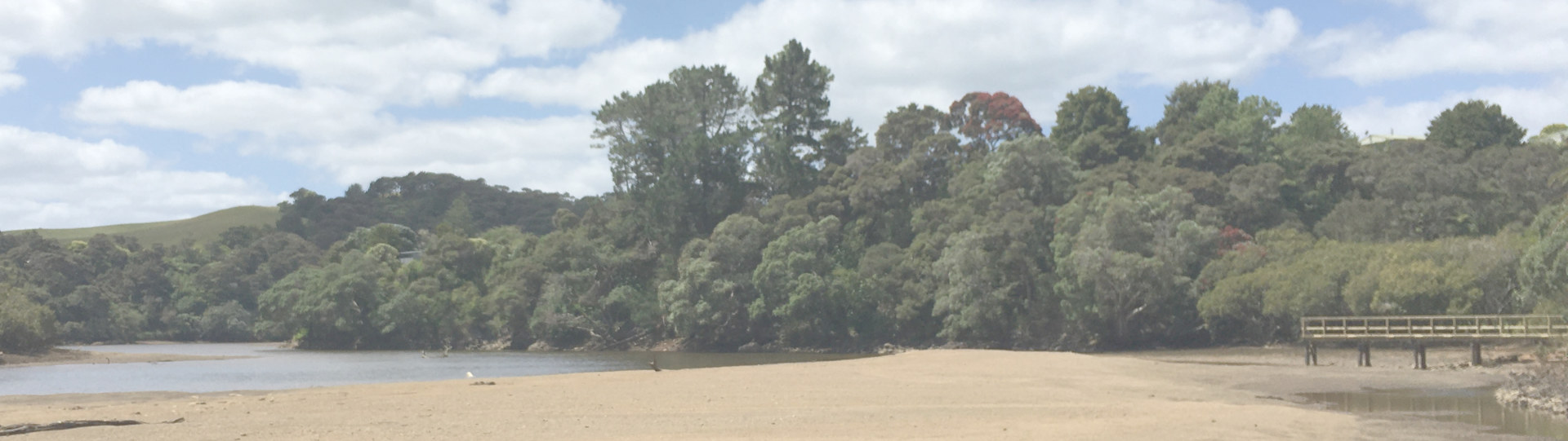
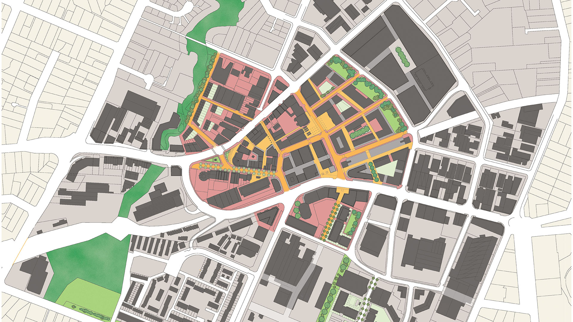
Most of the 2.3ha site is a promontory situated just below the Haruru Falls. The site is an old lava tongue interrupting the flow of the Waitangi River and commanding the entrance to the western inland territories from the Waitangi Estuary, an atea to Peiwhairangi – the Bay of Islands. Its 10—20m high Pohutukawa-clad escarpment walls mirrored by the opposite bank assert a presence over the river and demand a natural response.
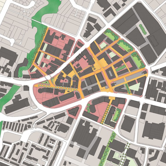
Destined for residential development doesn’t mean that you have to give up the identity and ‘meaning’ of the site in its wider landscape and cultural context. Our solution was to strengthen all the elements that describe and define that identity – particularly vegetation and connectivity networks. The design idea is to extend as a mesh across the whole site the things that create the ‘value’ – and then slide dwellings into the pattern that evolves. The resulting environment is overwhelmingly pedestrian-dominant, with poor old cars being snuck in and hidden away out of sight. The aim has been to make people and their living, warming the site, be something that adds to the naturalness without diminishing it in any way.
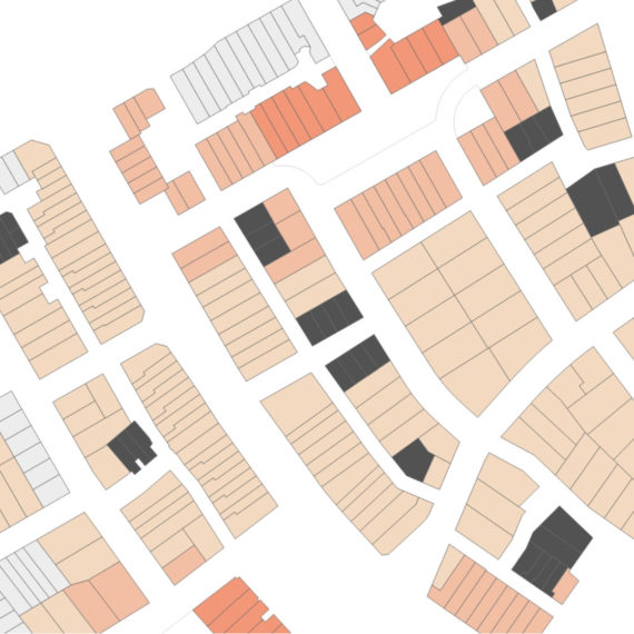
But did it work? We ran a standard RSP (Residential Subdivision Performance) analysis on the scheme which returned a record-breaking score of 98/100. Is that actually possible? Maybe the RSP tool’s broken? We thought about it, and here’s the lesson…
Most sites contain some really good quality parts, and some not so good. It might be theoretically possible to completely design out all the not-so-goods, but real-world practice shows us that 90/100 is about as good as it gets. Hobsonville Point, for example, only scored 44/100. The point of RSP analysis is not a competition though – it’s to make visible the existence and interactions of matters that affect urban functionality. In a word, urban quality. Two words actually (but who’s counting?).
From doing a lot of these sorts of analyses we know that what makes the biggest difference to urban performance is the extent and quality of open-space provision and how well that can be utilised. Yorke Rd has quality open-space in spades, and I thought we’d done a pretty good job so guessed 90—91 in the office sweep-stake. But hey, 98, really?
2.3ha is quite small in development terms. When I take a big site of real quality and extract the best 2.3ha, well, it scores 98—100 as well. So not much of a mystery after all. What it says though is that pretty much the whole of the Yorke site has a very high inherent value. And in this case, the design has matched the value [whew – sigh of relief].
All this makes us think… we’ve developed the RLP tool which can measure the extent to which the lot design (building and landscape design at BC) supports the potential urban value of the subdivision (as measured by the RSP tool). Is it possible to analyse the potential urban quality of a site before subdivision consent? And then use the RSP to show how well the design supports the intrinsic value of the site?
Hmm. Inherent Site Value. That would be useful.
- Landscape/Context Analysis
- Concept Subdivision Design
- Urban Design
- Alternative Development Guidelines
- Visual Effects Analysis
Project Value:
$NZ 12,000,000
Value of Services Provided:
$NZ 37,000
Added Value:
- Fully connected Esplanade Reserve walkway
- Fully functional open-space network
- Enabled open-space connection to Haruru central
- Resource Consent


